Paddling to Durney Key
For experienced paddlers looking to explore beyond the park, Durney Key is a fun island escape, over a mile offshore.
As the only place to swim in the area, it’s a favorite destination for snorkeling, picnicking, and even bringing your dog along for the adventure. It’s also a great spot to appreciate the nearby historic stilt houses.
This trip requires open-water experience, as reaching Durney Key means paddling unprotected waters and crossing a boat channel. Conditions should be calm for a safe journey, and we strongly recommend reserving a four-hour or full-day rental, as a two-hour rental does not allow enough time for the trip.
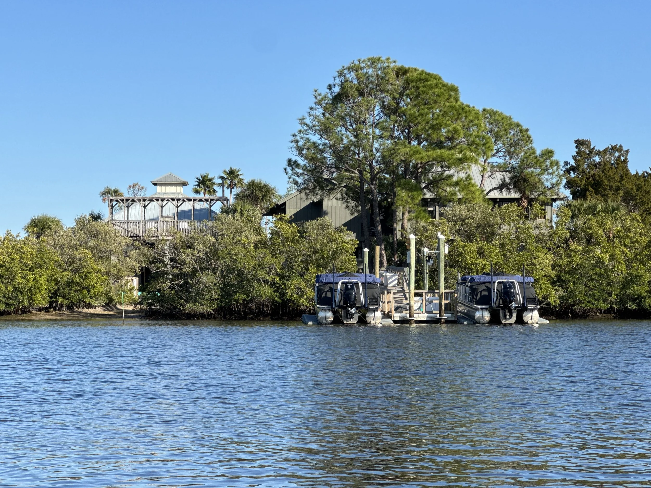
Energy and Marine Center
Directions to Durney Key
Durney Key is a small island that takes experienced paddlers approximately 60 to 90 minutes to reach one way, with the return trip often taking longer. This is a challenging paddle with open water and boat traffic. Do not underestimate the distance or conditions. If you decide to paddle to Durney Key, you must be prepared to paddle back.
Going to Durney Key:
The Pasco County Schools Energy & Marine Center is a key landmark at the entrance of the inlet where the Salty Dog launch is located.
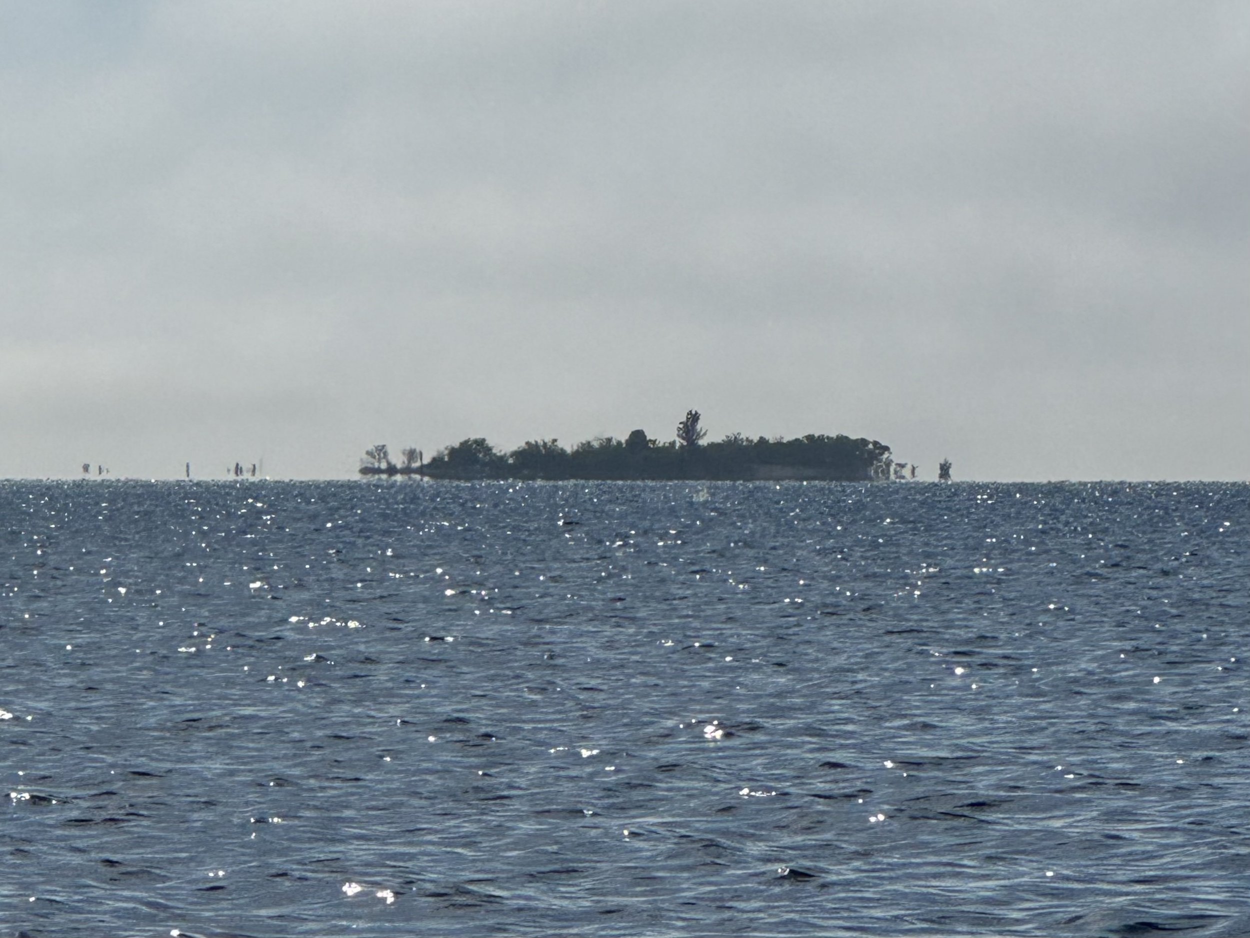
Paddle southwest from Salt Springs Run toward Durney Key. Look for the tall tree in the center of the island.
Cow Key (marked on Google Maps) will be on your left as you paddle toward Durney Key.
Stay alert for boat traffic—this area has no no-wake zone.
Use extreme caution when crossing the boat channel east of Durney Key. Cross where the channel is clearly defined (green and red channel markers) Check for boats in both directions and, if paddling with others, cross as a group.
Durney Key from a distance
On Durney Key
Secure your kayak well above the waterline—rising tides can quickly carry it away.
Be aware of weather conditions, including dark clouds developing, increasing wind, or shifting tides, which can impact your return trip.
Set an alarm to remind yourself when to start heading back, allowing extra time for the return paddle.
Expect the return trip to take longer than the paddle out, especially if conditions change.
Returning to Salty Dog
Cautiously cross the boat channel, passing between the green and red markers on the north side of Durney Key.
Paddle in a northeasterly direction back toward Salt Springs Run. Use the Google Maps GPS coordinates of Salty Dog to ensure you’re heading in the right direction.
Look for Cow Key on your right (to the south) as you head back and again use the Durney Key paddle trail map to confirm your location.
Once in Salt Springs Run, use mental markers from the way out to stay on course.
Spot the Energy and Marine Center in the distance as a reference point and continue toward it. Follow the orange buoys to the Salty Dog launch.
Reach out sooner rather than later: If you're unsure of your location, send a screenshot of your Google Maps location to 813-540-5778 for guidance. If you don’t receive a response within 10 minutes, please call us, as we may be assisting another customer.


